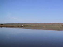
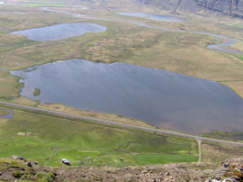
Vestmannsvatn

Lake Vestmannsvatn


Location:

Vestmannsvatn is located in Sudur-Þingeyjarsyslu in North-Eastern Iceland.
 

Practical information:

The lake is 2.4 km2  Reykjadalsa river runs to the lake and Eyvindará river runs from the lake.  The maximum deep is about 10m with an average depth of 2 metre. 
 

Distance from Reykjavik and the nearest township.

Distance from Reykjavik is about 455 km and 24 km south of Husavik. The lake is by the road no. 845
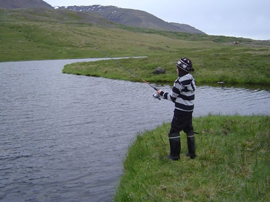
 

Fishing area:

You can fish the whole lake, but no closer to the rivers than 100m.    
 

Accommodation: 

There are many option in the area.  Camping and restaurant can be found at Dalakofinn, Laugum that is few km away from the lake ( more info at www.dalakofinn.is) 
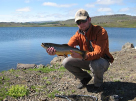
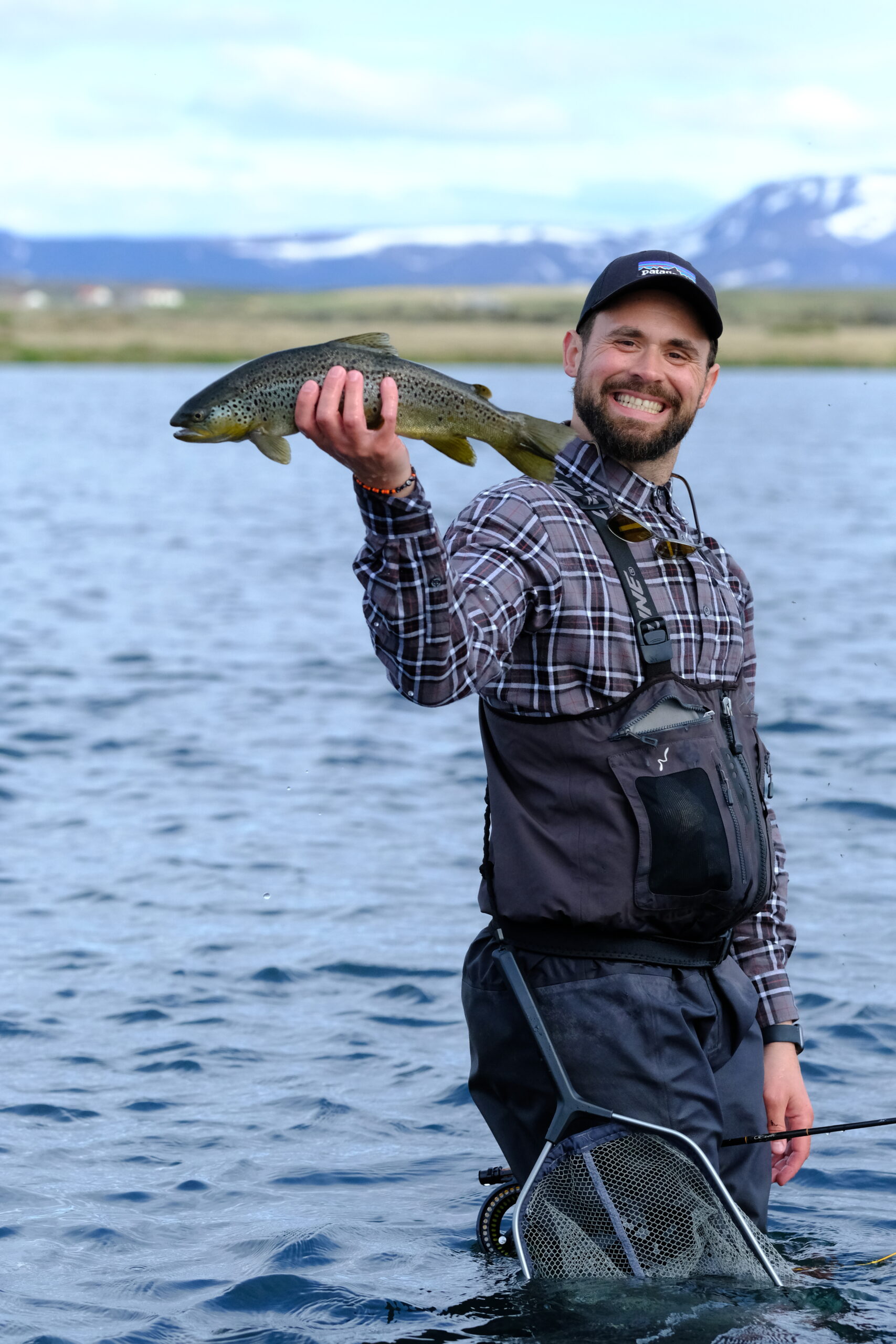
 

Fishing potential: 

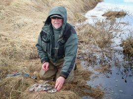
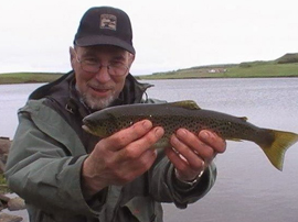
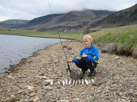
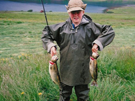
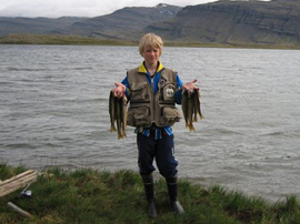
Both brown trout and char can be caught in the lake among with occasional salmon.
 

Daily opening hours: 

Fishing is allowed from dawn to dusk.
 

Fishing season:

Fishing season starts 15th of May and ends 30th of September.
 

Bait: 

Fly, lure and worm is allowed.
 

Best time of the year:

Best season is early summer and late summer, thought is is rather even.  Fishing is best in the morning and evening but it is also very good in the mid-day.
 

Rules:

Please register before attending to fishing at Dalakofinn (Laugum) and show the Fishing card and some ID.  Littering and off-road driving is forbidden.  Children under 14 are allowed for free, if accompanied by adult cardholder.  Dogs are not allowed to run free in the area since it is rich of birdlife.
 

Contact:

Dalakofinn, restaurant Tel.: 354-464-3344 – www.dalakofinn.is
 
{pgsimple id=13|caption=0|tsize=medium|tmax=20|imax=200|close=1}
 
{weather 5}


View Larger Map

Gislholtsvatn

Gislholtsvatn

 
Location:  Hnit: 63° 56,842’N, 20° 30,179’W
Gíslholtsvatn is located in Holtum, near the town Hella that is on  the South coast of Iceland.
 

Distance from Reykjavík and the nearest township:

Distance from Reykjavik is  85 km to the lake.  Turn to road Heiðarveg no. 284 from Highway no. 1,
 

Practical information:

There are two lakes in the area.  Cardholders can only fish in the eastern lake, in the west part of that lake, in the land of Gislholt.  The lake covers about 1,6 km2 and rises 65m above sea level.    The greatest deep is about 8m but average depth is about  2.5 m.
 

Fishing area: 

Fishing is allowed in the west part of the eastern lake, see map in the brochure.
 

Accommodation:

Camping is available.  Please contact landlord prior to camping.
 

Fishing potentiali:  

Brown trout and char can be cought in the lake.  There is a good potetional through the summer.  . 
 

Daily opening hours: 

You can fish day and night..
 

Fishing season:

All year around.  You can also fish through ice in accordance with the landlord.
 

Bait:

Fly, lure and worm.
 

Best time of the year:

The peak season is May – June, thought there is a good fishing through the summer.
 

Additonal information:

Please take care near some banks, because they can be fragile.
 

Rules:

Littering is forbidden.  Please have the Fishing Card visible in your front car window for the landlord when he visit and check.   Fishing is only allowed on the property of Gislholt. No dogs are allowed to run free by the lake. Children are allowed, free of charge, if accompanied with adult cardholders.  .
 

Landlord / Contact:

Bryndís Dyrving, at farm Gíslholt, Tel: 487-6553 /
GSM: 847-5787
 
 
22.11.2013
 
 
{pgsimple id=14|caption=0|tsize=medium|tmax=20|imax=200|close=1}
 
 
{weather 9}


See bigger map

Þveit

Þveit

(lake Þveit)


Location:

Þveit is located in Nesjahreppur, Austur-Skaftafellssýsla (South-East Iceland).
 

Distance from Reykjavík and the nearest township:

Distance from Reykjavík is 450 km. and 10 km from Höfn in Hornafjörður, the principal town in South-East Iceland. The lake is located at Highway 1. The access to the lake is quite good.
 

Practical information:

The lake covers an area of 0,91 km2  and rises to 2 m above sea level. Sea char can be found there.
 

Fishing area:

Fishing is allowed on the property of Stórulágar, comprising about half of the lake.
 

Accommodation:

Nearest hotel is Fosshótel Vatnajökli,  only 2 km. away.
 

Fishing potential:

In the lake you will find brown trout and char, along with sea trout and sea char.  The sea trout can be quite big!
 

Daily opening hours:

10.00 am -10.00 pm.
 

Season:

April 1st  –  September 30th.
 

Bait:

Fly, worm and lure.
 

Best time of the year:

Spring and fall.
 

Rules:

Fishing is only allowed on the property of Stórulag. No dogs are allowed at the lake and the use of boats is prohibited without permission from the landlord. Littering is strictly forbidden.  Cardholders can go directly to fish but need to have the Fishing Card handy when the landlord might ask for it. Off-road driving is prohibited. Children are allowed, free of charge, if accompanied with adult cardholders.   Please contact landlord before driving on the property.


{pgsimple id=9|caption=0|tsize=medium|tmax=20|imax=200|close=1}
 
 
{weather 6}

Saenautavatn

Sænautavatn

(Lake Sænaut)


Location: 

Sænautavatn is located at Jökuldalsheiði, by Sænautasel, in the North-East of Iceland.
 

Distance from Reykjavík and the nearest township:

Distance from Reykjavík is 600 km, 74 km from Egilsstaðir and 13 km, from Highway 1.
 

Practical information:

The Lónskvísl river, one of Hofsá river’s tributaries, has its origin there. 
Halldor Laxness, Iceland best known author and a Nobel laureate, stayed in Sænautasel on his journey from eastern Iceland to Reykjavik in 1926. That small farm proved to be a haven from the terrible weather Mr. Laxness encountered.
 

Fishing area:

No restrictions.
 

Accommodation:

Access to the camping area can be bought.
Lodging might also be available at Sænautasel or at Skjoldolfsstodum that is about 20 km away from the lake.
 

Fishing potential:

Char is abundant in the lake, both small and large. The best place to catch is where the shallow and deep water meet.
 

Daily opening hours:

No restrictions.                      
 

Season:

May 1st to September 20th.
 

Bait:

Only fly, worm and lure.  All other bait is strictly forbidden.
 

Best time of the year:

The peak season is early summer, yet one might expect good catch all season.
 

Other:

It is possible to buy some refreshments at Sænautasel or even order a dinner in advance.
 

Rules:

Littering is forbidden. Cardholders must sign up at Sænautasel and show both the Veiðikortið and an appropriate ID. Children under 14 are allowed for free, if accompanied by adult cardholder.
 

Contact / landlord:

Lilja Óladóttir at Sænautasel. Tel: (+354) 892-8956 or (+354) 853-6491.
 
{pgsimple id=17|caption=0|tsize=medium|tmax=20|imax=200|close=1}
 
 
{weather 6}


View Larger Map

Skriduvatn

Skriðuvatn 

(Lake Skriða)


Location:

Skriðuvatn lies in Skriðdalur, S-Múlasýsla, on the East Coast of Iceland. 
 

Distance from Reykjavík and the nearest township:

Distance from Reykjavík is 650 km, and 35 km from Egilsstaðir.
 

Practical information:

Skriðuvatn covers an area of 1,25 km2 and rises to 155 m above sea level, with a max depth of 10 m.
Its main tributaries are the rivers Axará and Vatnsdalsá. Múlaá is its main outflow.
 

Fishing area:

The property of Vatnsskógar (marked) as well as the eastern bank of Axará. 
 

Accommodation:

No organized campsite is available, one may however camp wherever possible at the Vatnsskógar property. 
Accommodation can also be found at the towns of Egilsstaðir, Breiðdalsvík and Djúpivogur.
 

Fishing potential:

Brown trout and char are the most likely catch.  Fishing in nets is prohibited.
 

Fishing hours:

08.00 am to 10.00 p.m.
 

Fishing season:

June 1st to September 15th
 

Bait:

All bait is allowed: Fly, worm and lure.
 

Rules: 

Cardholders must carry the Veiðikortið and an appropriate ID on their person, ready for inspection at any time. Littering is strictly forbidden. Children under 14 are allowed for free, if accompanied by adult cardholders.
 

Contacts/landlords:

 Ívar Björgvinsson at Vatnsskógum in Skriðdalur.
 
{pgsimple id=19|caption=0|tsize=medium|tmax=20|imax=200|close=1}
 
 
{weather 7}

Mjoavatn in Breiddal

Kleifarvatn and Mjoavatn in Breiddal


Location:

Kleifarvatn and Mjóavatn are located in Breiðdalur (East Coast).
 

Distance from Reykjavík and the nearest township:

Distance is approx. 600 km. from Reykjavík and 75 km. from Egilsstaðir 
 

Practical information:

The lake district, including Kleifarvatn and Mjóavatn, is located near Highway 1, near the village of Breiðdalsvík. Kleifarvatn covers about 1km2 and Mjóavatn about 0,15 km2.
 

Fishing area:

No restrictions.
 

Accommodation:

Camping is permitted at a designated place discussed with the landowner. No hygiene facilities are available at the campsite.


Fishing potential:

One can expect to catch medium size brown trout in the lakes.
 

Fishing hours:

No limits, 24 hours.
 

Season:

May 1st to September 30th
 

Bait:  

All bait is allowed: fly, worm and lure.. 
 

Best fishing time:

Rather even all day and night.
 

Rules:

Cardholders must register at the place of contact, and show both Veiðikortið and an appropriate ID. There they will receive a report form to fill out and return after fishing. Littering is strictly forbidden as well as off-road driving. Children are allowed, free of charge, accompanied with adult cardholders. 
 

Contact / landlord:

Gunnlaugur Ingolfsson at Innri Kleif. Tel: (+354) 475-6754 or mobile (+354) 858-7354.


{pgsimple id=34|caption=0|tsize=medium|tmax=20|imax=200|close=1}
 
 
{weather 7}


Sýna stærra kort

Kleifarvatn in Breiddal

Kleifarvatn  (and Mjoavatn 18)


Location:

Kleifarvatn and Mjóavatn are located in Breiðdalur (East Coast).
 

Distance from Reykjavík and the nearest township:

Distance is approx. 600 km. from Reykjavík and 75 km. from Egilsstaðir 
 

Practical information:

The lake district, including Kleifarvatn and Mjóavatn, is located near Highway 1, near the village of Breiðdalsvík. Kleifarvatn covers about 1km2 and Mjóavatn about 0,15 km2.
 

Fishing area:

No restrictions.
 

Accommodation:

Well equipped cabins can be rented. Booking must be made in advance at the place of contact (Tel: (+354) 475-6789 or mobile (+354) 896-4239). Camping is permitted at a designated place. No hygiene facilities are available at the campsite.


Fishing potential:

One can expect to catch medium size brown trout in the lakes.
 

Fishing hours:

No limits, 24 hours.
 

Season:

May 1st to September 30th
 

Bait:  

All bait is allowed: fly, worm and lure.. 
 

Best fishing time:

Rather even all day and night.
 

Rules:

Cardholders must register at the place of contact, and show both Veiðikortið and an appropriate ID. There they will receive a report form to fill out and return after fishing. Littering is strictly forbidden as well as off-road driving. Children are allowed, free of charge, accompanied with adult cardholders. 
 

Contact / landlord:

Gunnlaugur Ingolfsson at Innri Kleif. Tel: (+354) 475-6754 or mobile (+354) 858-7354..
 
 
{pgsimple id=35|caption=0|tsize=medium|tmax=20|imax=200|close=1}
 
 
{weather 7}


Sýna stærra kort

Urridavatn

Urriðavatn

(Lake Trout)


Location 

Urriðavatn is close to Egilsstaðir, the largest town in Eastern Iceland
 

Distance from Reykjavík and the nearest township

Distance from Reykjavik is 664 km and only 5km from Egilsstaðir.  Highways 1 and 925 run by the lake.
 

Practical information

The lake covers an area of 1,1km2 (0.42 miles2) and rises 40m above sea level. The lake is 15 m at deepest point. The creeks Hafralónslækur and Merkilækur are its main tributaries.
 

Fishing area

No restrictions. The best place for fishing is where the creeks enter the lake.
 

Accommodation:

Camping is not allowed by the lake. You can buy camping permit at Skipalaek that is close to Lagarfljot.
 

Fishing potential: 

In the lake nemed after the brown trout, you can only catch char! The average size is about 1 pound.  The reason for the name is that it used to be a great brown trout lake, but not anymore.  The char can be quite nice.
 

Daily openings hours:

Fishing is allowed from dawn to dusk.
 

Season:

No restrictions.
 

Bait:  

All bait is allowed: fly, worm and lure.
 

Best time of the year: 

The best time is in the spring, when the ice has melted.
 

Rules:

Littering and off-road driving is forbidden. Cardholders must sign up at Urridavatn farm and show both the Veiðikortið and an appropriate ID. Children under 14 are allowed for free, if accompanied by adult cardholder.
 

Contact / Landlord:

Jón Steinar Benjamínsson at Urriðavatn. Tel: (+354) 471-2060
 
{pgsimple id=31|caption=0|tsize=medium|tmax=20|imax=200|close=1}
 
 
{weather 6}


View Larger Map

Haugatjarnir

Haugatjarnir 

(The Haugar Ponds)


Location:

Haugatjarnir are located in Skriðdalur, on the East coast of Iceland.
 

Distance from Reykjavík and the nearest town:

Distance from Reykjavík is 650 km, and 35 km from Egilsstaðir.
 

Practical information:

The Haugatjarnir is comprised of two large ponds, packed with fish and easily accessible.
 

Fishing area: 

No restrictions.
 

Accommodation:

No organized campsite is available, one may however camp wherever possible.
 

Fishing potential:

One can only expect brown trout.
 

Fishing hours:

No restrictions.
 

Season:

May 1st to September 30th.
 

Bait:

All bait is allowed: fly, worm and lure.
 

Best season:

There is an equal prospect throughout the season.
 

Rules: 

Littering and off-road driving is prohibited.
Cardholders must register at the place of contact, showing both the Veiðikortið and an appropriate ID. Children under 14 are allowed for free, if accompanied by an adult cardholder.
 

Contact / Landlord:

Hugrún Sveinsdóttir, Haugar. Tel: (+354) 892-7813.
 
{pgsimple id=27|caption=0|tsize=medium|tmax=20|imax=200|close=1}
 
 
{weather 7}

Hólmavatn

Holmavatn


Location:      GPS: 65° 14,475’N, 21° 22,921’W

Holmavatn is located on Holmavatnsheidi (highlands), north of the farm Solheimar.
 

Practical information:

The lake is 2.4 km2.  Reykjadalsa river runs to the lake and Eyvindará river runs from the lake.  The maximum deep is about 10m with an average depth of 2 metre. 
 

Distance from Reykjavik and the nearest township.

Distance from Reykjavik is about 180 km and 30 km from Budardal.  If you take the road called Brattabrekka, you just take a right turn just before arriving at river Laxa I Dolum.  The turn leads you to road no. 59 (Laxardalur)  You drive about 25 km to the the farm Solheimar.  From the farm you need to drive about 5 km to the lake.  The road up to the lake is 4×4 vehicles only.  You can also take the Holtavorduheidi road instead of Brattabrekka. Check road atlas.
 

Fishing area:

You can fish in the land of Solheimar.  Please see the blue line on the map in the Veidikortid brochure.
 

Accommodation: 

Camping is free of charge, however there are no toilets or any other hygiene facilities. 
 

Fishing potential: 

There is an excellent prospect for brown trout fishing. The average size of an individual catch is about 1-2 pounds.
 

Daily opening hours: 

Fishing is allowed from dawn to dusk, but you need to register between 07:00-22.00.
 

Fishing season:

Fishing season starts around mid June when the roads are ready, and it ends 30th of September.
 

Bait: 

Fly, lure and worm is allowed.
 

Best time of the year:

It is equl fising through the whole fishing period.
 

Rules:

Please register before attending to fishing at Solheimar farm and show the Fishing card and some ID.  Littering and off-road driving is forbidden.  Children under 14 are allowed for free, if accompanied by adult cardholder.  Fishermen will be given a emty report to fill in that must be delivered to the farm before leaving.
 

Contact:

Dadi Einarsson, Solheimar.


{pgsimple id=10|caption=0|tsize=medium|tmax=20|imax=200|close=1}
 
 
{weather 2}


View Larger Map